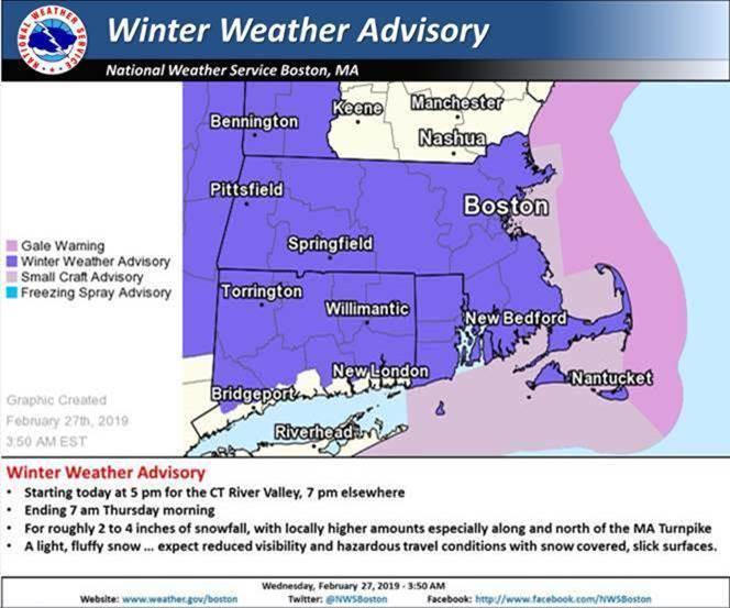
The National Weather Service is forecasting a plowable snow event beginning late this afternoon and continuing through the early morning hours on Thursday. While the onset is forecast to begin late this afternoon, there may be impacts to the Thursday morning commute. Temperatures are also forecast to be cold, with widespread values from the upper teens through about 20 degrees.
MEMA reports that:
- Light snow will spread across all of Southern New England.
- Beginning late this afternoon into evening for the CT River Valley, 4-6 p.m., spreading over the remainder of S New England, 6-8 p.m.
- Bulk of the snowfall occurring around 10 pm to 4 a.m. Thursday with snowfall rates less than an inch per hour.
- Snow tapering 4- 7 a.m. Thursday, west to east.
- Total snow accumulations around 2 to 4 inches with locally higher amounts.
- The potential exists for a swath of 3-6 inches of snow within 20 miles north or south of the MA-Pike, including the Berkshires and greater Worcester and Boston Metro Areas.
- Not ruling out amounts that could come close to warning-level criteria of 6 inches.
Given temperatures will be around 20 degrees/upper teens for most areas throughout the event. Residents should expect:
-
-
-
- Snow accumulation on all surfaces.
- A light and fluffy snow, with snowfall rates less than an inch per hour, should make for easy and quick clean-up.
- Treatments may have difficulty working given cold temperatures forecast overnight.
- Expect reductions in visibility and hazardous travel conditions.
-
-


 Welcome to the Stoneham Fire Department website. The Stoneham Fire Department is committed to protecting and preserving life, property, and the environment in the community in the most professional and courteous manner possible.